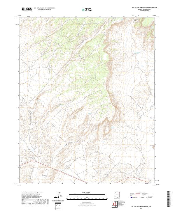
2021 Map of Big Willow Spring Canyon
USGS Topo · Published 2021About this map
The high desert landscape of Apache County is defined here by the winding course of Big Willow Spring Canyon, a region where the availability of water dictated human movement and settlement. At the southeastern edge of the quadrangle, the small settlement of White Rock sits near the intersection of Indian Rte 9051, representing one of the few concentrated areas of residence in this arid environment. The map details an intricate network of water sources vital for local life, ranging from the Toh Del Toshi Hydrant and Toh Del Toshi Spring in the northeast to the poignantly named Looking for Water Spring. These points, along with Big Willow Spring and Sunrise Spring, are connected by a sparse system of rural routes and Indian Routes such as Indian Rte 9056, illustrating the enduring reliance on scattered natural resources within the expansive canyon terrain.
Find a feature on this map
22 named features on this map. Tap any name to fly to it.
Don’t see what you’re looking for? This feature index may not catch every label — zoom into the map to look around manually.
Map Details
Editions of this 2021 Big Willow Spring Canyon Map
This is the sole edition of this map. No revisions or reprints were ever made.
Other maps of this area

1883 · Tusayan
USGS Topo · 1:250,000

1886 · Tusayan
USGS Topo · 1:250,000

1886 · Fort Defiance
USGS Topo · 1:250,000

1892 · Fort Defiance
USGS Topo · 1:250,000

1947 · Flagstaff
USGS Topo · 1:250,000

1954 · Flagstaff
USGS Topo · 1:250,000

1954 · Gallup
USGS Topo · 1:250,000

1958 · Gallup
USGS Topo · 1:250,000

1958 · Flagstaff
USGS Topo · 1:250,000

1959 · Gallup
USGS Topo · 1:250,000
Featured Places
- Fort Defiance Agency
- Béésh Biiʼtó, Fort Defiance Agency
- Navajo County, AZ
- Apache County, AZ
- United States