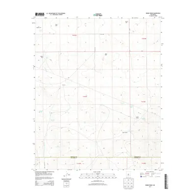
2013 Map of Bigbee Draw
USGS Topo · Published 2013About this map
Cain Ranch sits as a central human landmark in this high-desert landscape, where survival depends on a network of water collection points. The drainage patterns of Bigbee Draw and Piñon Draw define the northern terrain, while the southern portion is marked by the winding path of the Arroyo Seco. The importance of water management in this arid region is evident through numerous named tanks, such as Little Seco Tank, Big Seco Tank, and Jog Tank. The map also illustrates the transition across the Torrance and Socorro County line, documenting the sparse road network including NM-55 and Co Road 8005 that connects these remote ranching lands. Geologically, the area is characterized by elevations rising toward West Mesa and the rugged descents of North Canyon and South Canyon.
Find a feature on this map
30 named features on this map. Tap any name to fly to it.
Don’t see what you’re looking for? This feature index may not catch every label — zoom into the map to look around manually.
Map Details
Editions of this 2013 Bigbee Draw Map
This is the sole edition of this map. No revisions or reprints were ever made.
Other maps of this area

1954 · Socorro
USGS Topo · 1:250,000

1958 · Socorro
USGS Topo · 1:250,000

1962 · Socorro
USGS Topo · 1:250,000

1972 · Turkey Ridge
USGS Topo · 1:24,000

1972 · Gran Quivira
USGS Topo · 1:24,000
1972 · Chupadera Spring
USGS Topo · 1:24,000

1972 · Chupadera
USGS Topo · 1:24,000

1972 · Bigbee Draw
USGS Topo · 1:24,000
1972 · Turkey Ridge NE
USGS Topo · 1:24,000

1972 · Abo
USGS Topo · 1:24,000