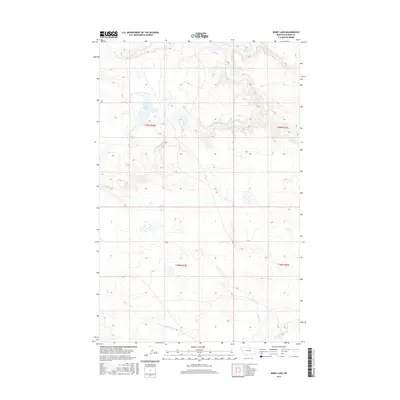
2017 Map of Bigby Lake
USGS Topo · Published 2017About this map
Bigby Lake is the central hydrological feature of this northern Montana landscape, located in a region defined by the complex drainage systems of the Milk River basin. The area is characterized by high plains terrain where intermittent and seasonal waterways have carved distinct patterns across the township lines. Fifteenmile Cr and White Bear Cr cross the northern sections, while the southern reaches are shaped by Peoples Cr and its S Fork Peoples Cr. This 2017 survey details the land management grid of the Agency District in Blaine County, capturing the remote prairie character before any major modern development altered the drainage basins and natural wetlands surrounding the namesake lake.
Find a feature on this map
9 named features on this map. Tap any name to fly to it.
Don’t see what you’re looking for? This feature index may not catch every label — zoom into the map to look around manually.
Map Details
Editions of this 2017 Bigby Lake Map
This is the sole edition of this map. No revisions or reprints were ever made.
Other maps of this area

1953 · Havre
USGS Topo · 1:250,000

1957 · Havre
USGS Topo · 1:250,000

1958 · Havre
USGS Topo · 1:250,000

1964 · Threemile Reservoir
USGS Topo · 1:24,000

1964 · Coburg
USGS Topo · 1:24,000
1964 · Savoy
USGS Topo · 1:24,000

1964 · Weigand Reservoir
USGS Topo · 1:24,000

1971 · Lodge Pole NW
USGS Topo · 1:24,000

1971 · Lodge Pole NE
USGS Topo · 1:24,000
1971 · Bigby Lake
USGS Topo · 1:24,000