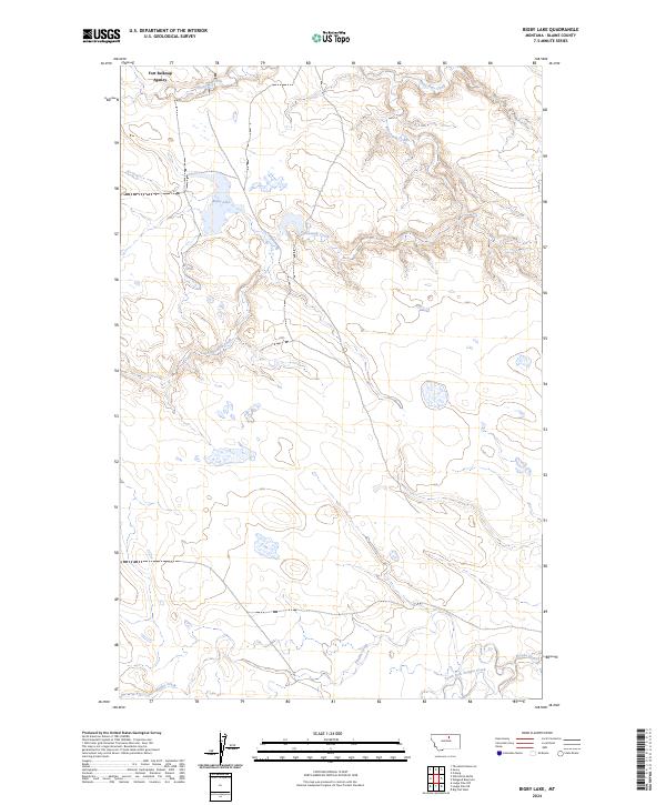
2024 Map of Bigby Lake
USGS Topo · Published 2024About this map
Fort Belknap Agency serves as the focal point of this northern Montana landscape, situated within a topography defined by complex water systems. The northern portion of the map is dominated by the namesake Bigby Lake and the winding course of White-Bear Creek, while the southern reaches are shaped by the convergence of Peoples Creek and the South Fork Peoples Creek. This 2024 edition documents a region where contemporary mapping techniques illustrate the persistent influence of intermittent waterways like Fifteenmile Creek on the prairie terrain. The absence of dense road networks highlights the agrarian and natural character of the land, preserving the original township and range structure across the Fort Belknap Agency jurisdiction.
Find a feature on this map
11 named features on this map. Tap any name to fly to it.
Don’t see what you’re looking for? This feature index may not catch every label — zoom into the map to look around manually.
Map Details
Editions of this 2024 Bigby Lake Map
This is the sole edition of this map. No revisions or reprints were ever made.
Other maps of this area

1953 · Havre
USGS Topo · 1:250,000

1957 · Havre
USGS Topo · 1:250,000

1958 · Havre
USGS Topo · 1:250,000

1964 · Threemile Reservoir
USGS Topo · 1:24,000

1964 · Coburg
USGS Topo · 1:24,000
1964 · Savoy
USGS Topo · 1:24,000

1964 · Weigand Reservoir
USGS Topo · 1:24,000

1971 · Lodge Pole NW
USGS Topo · 1:24,000

1971 · Lodge Pole NE
USGS Topo · 1:24,000
1971 · Bigby Lake
USGS Topo · 1:24,000