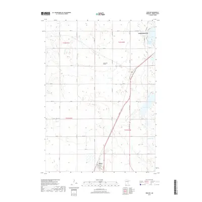
2019 Map of Bigelow
USGS Topo · Published 2019About this map
Worthington anchors the northern edge of this Nobles County landscape, where the agricultural grid meets the waters of Okabena Lake. This portion of the Coteau des Prairies plateau reveals a complex water system, ranging from the meandering Little Rock River and Otter Cr to the engineered paths of Judicial Ditch Number Ten. The map documents the southern expansion of the county seat toward smaller settlements like Bigelow and Org, which are connected by a network of county roads and local avenues. Genealogists may find value in the location of Ransom Cem, situated near the township boundary. The southern reaches are defined by Ocheda Lake and the headwaters of the Ocheyedan River, illustrating the diverse hydrology of this prairie region at the close of the 2010s.
Find a feature on this map
48 named features on this map. Tap any name to fly to it.
Don’t see what you’re looking for? This feature index may not catch every label — zoom into the map to look around manually.
Map Details
Editions of this 2019 Bigelow Map
This is the sole edition of this map. No revisions or reprints were ever made.
Other maps of this area

1954 · Fairmont
USGS Topo · 1:250,000

1958 · Fairmont
USGS Topo · 1:250,000

1960 · Reading
USGS Topo · 1:24,000

1960 · Bigelow
USGS Topo · 1:24,000

1960 · Worthington North
USGS Topo · 1:24,000

1960 · Worthington South
USGS Topo · 1:24,000

1967 · Rushmore
USGS Topo · 1:24,000

1967 · Adrian NE
USGS Topo · 1:24,000

1972 · Ocheyedan
USGS Topo · 1:24,000

1972 · Sibley West
USGS Topo · 1:24,000