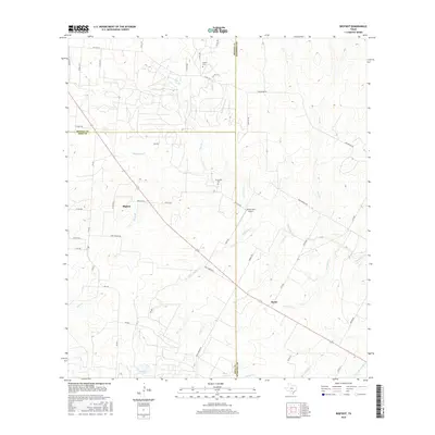
2016 Map of Bigfoot
USGS Topo · Published 2016About this map
The convergence of Frio, Medina, and Atascosa counties forms the backdrop for this rural South Texas landscape, defined by a dense network of creek branches and local farm-to-market roads. The community of Bigfoot sits along the western edge, while the settlement of Kyote anchors the southeast, positioned near the intersection of several regional routes and Kyote Lake. This area is characterized by its drainage patterns, with Elm Cr, Live Oak Cr, and Siestedero Cr carving through the terrain. Cultural history is preserved at the Griffin Cem and Brummett Cem, providing critical touchpoints for genealogical research in these county borderlands. The presence of the Ranch-Aero Airport and named thoroughfares like Old Devine Rd and Andy Sadler Rd illustrate the modern transportation framework supporting the region's agricultural and ranching operations.
Find a feature on this map
48 named features on this map. Tap any name to fly to it.
Don’t see what you’re looking for? This feature index may not catch every label — zoom into the map to look around manually.
Map Details
Editions of this 2016 Bigfoot Map
This is the sole edition of this map. No revisions or reprints were ever made.
Other maps of this area

1934 · Schattel
USGS Topo · 1:62,500

1942 · Natalia
USGS Topo · 1:62,500

1953 · Crystal City
USGS Topo · 1:250,000

1954 · San Antonio
USGS Topo · 1:250,000

1955 · Crystal City
USGS Topo · 1:250,000

1956 · Jourdanton
USGS Topo · 1:62,500

1957 · San Antonio
USGS Topo · 1:250,000

1958 · Somerset
USGS Topo · 1:24,000

1961 · Crystal City
USGS Topo · 1:250,000

1964 · Ghost Hill
USGS Topo · 1:24,000