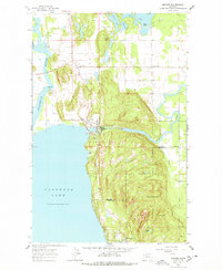
1962 Map of Bigfork
USGS Topo · Published 1978About this map
The Swan River and Flathead River converge near the northeastern shores of Flathead Lake, defining a landscape of complex waterways and early 1960s settlements. The community of Bigfork serves as a central hub, where the Big Fork Dam and the Big Fork Ranger Station mark the interface between civil infrastructure and the managed timberlands of the Flathead National Forest. This period shows a transition from scattered rural homesteads toward established lakeside communities like Woods Bay and Holt, connected by early road improvements including BR 2902.
Find a feature on this map
25 named features on this map. Tap any name to fly to it.
Don’t see what you’re looking for? This feature index may not catch every label — zoom into the map to look around manually.
Map Details
Editions of this 1962 Bigfork Map
Other maps of this area

1914 · Nyack
USGS Topo · 1:125,000

1920 · Flathead Lake
USGS Topo · 1:125,000

1943 · Kalispell
USGS Topo · 1:125,000

1955 · Choteau
USGS Topo · 1:250,000

1956 · Wallace
USGS Topo · 1:250,000

1957 · Choteau
USGS Topo · 1:250,000

1957 · Kalispell
USGS Topo · 1:250,000

1958 · Choteau
USGS Topo · 1:250,000

1960 · Kalispell
USGS Topo · 1:250,000

1960 · Wallace
USGS Topo · 1:250,000