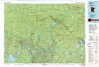
1976 Map of Bigfork
USGS Topo · Published 1994About this map
The Big Fork River carves a winding path through this mid-1970s survey, anchoring a landscape defined by an extensive network of state and national forests. The town of Bigfork serves as a central hub, accompanied by smaller settlements like Marcell, Talmoon, and Rauch. This era of the Minnesota Northwoods is characterized by numerous fire lookouts, including the Stony Ridge Lookout Tower and Link Lake Lookout Tower, which highlight the region's focus on timber management and forest protection.
Find a feature on this map
68 named features on this map. Tap any name to fly to it.
Don’t see what you’re looking for? This feature index may not catch every label — zoom into the map to look around manually.
Map Details
Editions of this 1976 Bigfork Map
This is the sole edition of this map. No revisions or reprints were ever made.
Other maps of this area

1918 · Zora
USGS Topo · 1:62,500

1919 · Zora
USGS Topo · 1:62,500

1919 · Lundgren
USGS Topo · 1:62,500

1919 · Gemmell
USGS Topo · 1:62,500

1919 · Max
USGS Topo · 1:62,500

1919 · Release
USGS Topo · 1:62,500

1919 · Marcell
USGS Topo · 1:62,500

1919 · M
USGS Topo · 1:62,500

1919 · Margie
USGS Topo · 1:62,500

1920 · Trout Lake
USGS Topo · 1:62,500