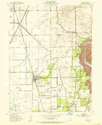
1952 Map of Biggs
USGS Topo · Published 1953About this map
Agricultural irrigation and transit networks define this 1952 landscape in the Sacramento Valley. The Southern Pacific and Sacramento Northern railroads provide the primary north-south axes, connecting the town of Biggs with outlying settlements like Richvale and East Biggs. This era is characterized by intensive land management, evidenced by the USDA Rice Experimental Sta and a complex system of water infrastructure including the Cherokee Canal, Main Drainage Canal, and numerous siphons.
Find a feature on this map
61 named features on this map. Tap any name to fly to it.
Don’t see what you’re looking for? This feature index may not catch every label — zoom into the map to look around manually.
Map Details
Editions of this 1952 Biggs Map
2 editions found
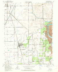
Other maps of this area

1888 · Marysville
USGS Topo · 1:125,000

1891 · Chico
USGS Topo · 1:125,000

1891 · Marysville
USGS Topo · 1:125,000

1893 · Chico
USGS Topo · 1:125,000

1894 · Marysville
USGS Topo · 1:125,000

1895 · Marysville
USGS Topo · 1:125,000

1895 · Chico
USGS Topo · 1:125,000

1911 · Landlow
USGS Topo · 1:31,680

1912 · Dry Creek
USGS Topo · 1:31,680

1912 · Oroville
USGS Topo · 1:31,680