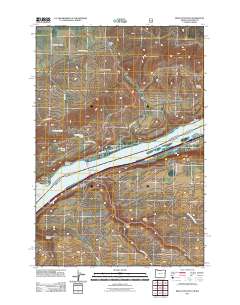
2011 Map of Biggs Junction
USGS Topo · Published 2011About this map
The Columbia River serves as the dominant geographic and economic spine of this 2011 survey, marking the border where the Columbia Hills rise to the north and the high plateaus of Oregon stretch to the south. Central to the region's connectivity is Biggs Junction, a vital transit hub where routes converge near the southern end of the Sam Hill Memorial Bridge. On the Washington side, the settlement of Maryhill is situated along the riverbank, framed by the steep terrain of Henderson Canyon and Davies Pass.
Find a feature on this map
35 named features on this map. Tap any name to fly to it.
Don’t see what you’re looking for? This feature index may not catch every label — zoom into the map to look around manually.
Map Details
Editions of this 2011 Biggs Junction Map
This is the sole edition of this map. No revisions or reprints were ever made.
Other maps of this area

1953 · The Dalles
USGS Topo · 1:250,000

1956 · The Dalles
USGS Topo · 1:250,000

1957 · The Dalles
USGS Topo · 1:250,000

1957 · Wasco
USGS Topo · 1:62,500

1957 · Goldendale
USGS Topo · 1:62,500

1957 · Wishram
USGS Topo · 1:62,500

1957 · Satus Pass
USGS Topo · 1:62,500

1971 · Rufus
USGS Topo · 1:24,000
1971 · Wasco
USGS Topo · 1:24,000
1974 · Locust Grove
USGS Topo · 1:24,000