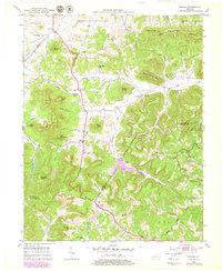
1952 Map of Bighill
USGS Topo · Published 1979About this map
The Central Kentucky Wildlife Management Area and Daniel Boone National Forest flank a landscape defined by the convergence of Madison, Jackson, and Rockcastle counties. The terrain is marked by prominent elevations like Indian Fort Mtn, West Pinnacle, and Pilot Knob, which overlook a network of narrow valleys and hollows. Small agricultural and residential pockets such as Bighill and Morrill are tied together by a dense system of local institutions, including Log Cabin Sch, Red Lick Ch, and New Liberty Ch.
Find a feature on this map
63 named features on this map. Tap any name to fly to it.
Don’t see what you’re looking for? This feature index may not catch every label — zoom into the map to look around manually.
Map Details
Editions of this 1952 Bighill Map
4 editions found
Other maps of this area

1892 · Richmond
USGS Topo · 1:125,000

1893 · London
USGS Topo · 1:125,000

1897 · Richmond
USGS Topo · 1:125,000

1897 · London
USGS Topo · 1:125,000

1952 · Alcorn
USGS Topo · 1:24,000

1952 · Berea
USGS Topo · 1:24,000

1952 · Bighill
USGS Topo · 1:24,000

1952 · Panola
USGS Topo · 1:24,000

1952 · Moberly
USGS Topo · 1:24,000

1953 · Richmond South
USGS Topo · 1:24,000