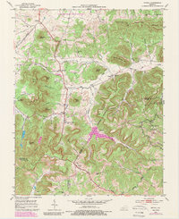
1952 Map of Bighill
USGS Topo · Published 1989About this map
Bighill and the surrounding knobs of the Cumberland Plateau foothills define this 1952 topographic study, capturing a rural landscape where the Knobs meet the mountains. The settlement pattern is largely dictated by narrow valleys and gaps, with communities like Dreyfus and Bobtown situated in the north, while Morrill anchors the southern boundary at the junction of three counties. Educational and spiritual life is well-documented through numerous rural landmarks such as Log Cabin Sch, Bighill Sch, and the New Liberty Ch.
Find a feature on this map
53 named features on this map. Tap any name to fly to it.
Don’t see what you’re looking for? This feature index may not catch every label — zoom into the map to look around manually.
Map Details
Editions of this 1952 Bighill Map
4 editions found
Other maps of this area

1892 · Richmond
USGS Topo · 1:125,000

1893 · London
USGS Topo · 1:125,000

1897 · Richmond
USGS Topo · 1:125,000

1897 · London
USGS Topo · 1:125,000

1952 · Alcorn
USGS Topo · 1:24,000

1952 · Berea
USGS Topo · 1:24,000

1952 · Bighill
USGS Topo · 1:24,000

1952 · Panola
USGS Topo · 1:24,000

1952 · Moberly
USGS Topo · 1:24,000

1953 · Richmond South
USGS Topo · 1:24,000