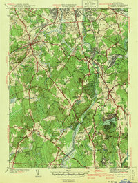
1941 Map of Billerica
USGS Topo · Published 1941About this map
The Concord River flows northward through a landscape of emerging suburban centers and established institutional grounds just before World War II. Local life is anchored by prominent educational and civic landmarks like the Howe High Sch and the Talbot Sch, while the presence of the U S Veterans Hospital and the Maryknoll Seminary in the southern reaches indicates the area's role in regional healthcare and religious life. The Boston and Maine railroad corridor supports industrial and residential nodes in North Billerica and South Lowell, connecting these mill-town communities to the broader Massachusetts economy.
Find a feature on this map
69 named features on this map. Tap any name to fly to it.
Don’t see what you’re looking for? This feature index may not catch every label — zoom into the map to look around manually.
Map Details
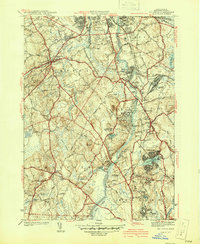
Editions of this 1941 Billerica Map
2 editions found
Other maps of this area

1886 · Lawrence
USGS Topo · 1:62,500

1886 · Lowell
USGS Topo · 1:62,500

1886 · Framingham
USGS Topo · 1:62,500

1888 · Lawrence
USGS Topo · 1:62,500

1889 · Framingham
USGS Topo · 1:62,500

1893 · Lowell
USGS Topo · 1:62,500

1893 · Boston
USGS Topo · 1:62,500

1893 · Lawrence
USGS Topo · 1:62,500

1894 · Framingham
USGS Topo · 1:62,500

1903 · Boston
USGS Topo · 1:62,500