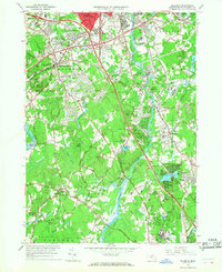
1965 Map of Billerica
USGS Topo · Published 1968About this map
The Concord River carves a central path through this mid-1960s Middlesex County landscape, serving as a historic corridor for both natural drainage and industrial development. In North Billerica, the river’s utility is evident near the Talbot Sch and a large filtration plant, while further south it flows past the residential pockets of Rio Vista and Riverside. The era is defined by the expansion of modern infrastructure, most notably the prominent U S Highway 3 and Interstate 495 interchanges which began to reshape the traditional town centers of Chelmsford Center and Billerica.
Find a feature on this map
87 named features on this map. Tap any name to fly to it.
Don’t see what you’re looking for? This feature index may not catch every label — zoom into the map to look around manually.
Map Details
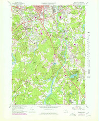
Editions of this 1965 Billerica Map
2 editions found
Other maps of this area

1886 · Lawrence
USGS Topo · 1:62,500

1886 · Lowell
USGS Topo · 1:62,500

1886 · Framingham
USGS Topo · 1:62,500

1888 · Lawrence
USGS Topo · 1:62,500

1889 · Framingham
USGS Topo · 1:62,500

1893 · Lowell
USGS Topo · 1:62,500

1893 · Boston
USGS Topo · 1:62,500

1893 · Lawrence
USGS Topo · 1:62,500

1894 · Framingham
USGS Topo · 1:62,500

1903 · Boston
USGS Topo · 1:62,500