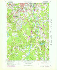
1965 Map of Billerica
USGS Topo · Published 1979About this map
The Concord River flows northward through this mid-century landscape, anchoring a corridor of industry and community development that defines the transition from Lowell into the surrounding townships. Suburban expansion is evident in the purple-shaded revisions of the late 1970s, showing new residential growth around established centers like Chelmsford Center and North Billerica. The map documents a significant institutional presence, ranging from the Veterans Administration Hospital in the south to the County House of Correction near Winning Pond.
Find a feature on this map
81 named features on this map. Tap any name to fly to it.
Don’t see what you’re looking for? This feature index may not catch every label — zoom into the map to look around manually.
Map Details
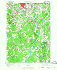
Editions of this 1965 Billerica Map
2 editions found
Other maps of this area

1886 · Lawrence
USGS Topo · 1:62,500

1886 · Lowell
USGS Topo · 1:62,500

1886 · Framingham
USGS Topo · 1:62,500

1888 · Lawrence
USGS Topo · 1:62,500

1889 · Framingham
USGS Topo · 1:62,500

1893 · Lowell
USGS Topo · 1:62,500

1893 · Boston
USGS Topo · 1:62,500

1893 · Lawrence
USGS Topo · 1:62,500

1894 · Framingham
USGS Topo · 1:62,500

1903 · Boston
USGS Topo · 1:62,500