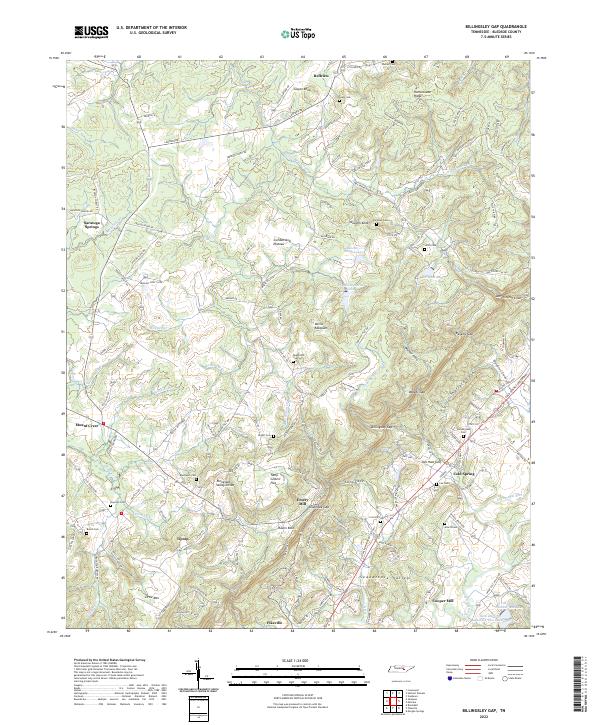
2022 Map of Billingsley Gap
USGS Topo · Published 2022About this map
Cumberland Plateau heights drop sharply into the Sequatchie Valley on this study of the Tennessee landscape. The physical geography is dominated by the Tennessee Valley Divide, which separates the drainage systems of the region, while gaps like Billingsley Gap and Rankins Gap provide natural passages through the escarpment. Settlement patterns follow the valley floor and the plateau summits, with small communities such as Cold Spring and Mount Crest established near reliable water sources and agricultural land.
Find a feature on this map
158 named features on this map. Tap any name to fly to it.
Don’t see what you’re looking for? This feature index may not catch every label — zoom into the map to look around manually.
Map Details
Editions of this 2022 Billingsley Gap Map
This is the sole edition of this map. No revisions or reprints were ever made.
Other maps of this area

1892 · Pikeville
USGS Topo · 1:125,000

1895 · Pikeville
USGS Topo · 1:125,000

1909 · Sequatchie Valley
USGS Topo · 1:62,500

1910 · Pikeville
USGS Topo · 1:62,500

1912 · Crossville
USGS Topo · 1:62,500

1935 · Melvine
USGS Topo · 1:24,000

1935 · Morgan Springs
USGS Topo · 1:24,000

1935 · Brockdell
USGS Topo · 1:24,000

1935 · Billingsley Gap
USGS Topo · 1:24,000
1935 · Vandever
USGS Topo · 1:24,000