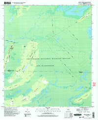
1994 Map of Billys Island
USGS Topo · Published 1994About this map
Billys Island stands as a prominent elevation within the heart of the Okefenokee National Wildlife Refuge and Wilderness, showing a landscape where human industry and nature have long intersected. The presence of Lee Cem and an extensive network of the Old Railroad Grade reveal a history of settlement and logging that predates the federal protection of the swamp. These tracks crisscross the terrain between Jackson Bay and Honey Island, marking the paths once used to extract timber from the deep interior.
Find a feature on this map
23 named features on this map. Tap any name to fly to it.
Don’t see what you’re looking for? This feature index may not catch every label — zoom into the map to look around manually.
Map Details
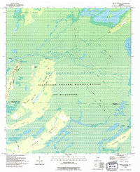
Editions of this 1994 Billys Island Map
2 editions found
Other maps of this area

1918 · Folkston
USGS Topo · 1:62,500

1918 · Moniac
USGS Topo · 1:62,500

1942 · Moniac
USGS Topo · 1:62,500

1954 · Valdosta
USGS Topo · 1:250,000

1958 · Valdosta
USGS Topo · 1:250,000

1959 · Valdosta
USGS Topo · 1:250,000

1965 · Chesser Island
USGS Topo · 1:24,000

1965 · Double Lakes
USGS Topo · 1:24,000

1965 · Chase Prairie
USGS Topo · 1:24,000

1965 · Blackjack Island
USGS Topo · 1:24,000