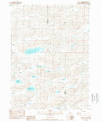
1989 Map of Billys Lake
USGS Topo · Published 1989About this map
The high plains of the Sheridan and Cherry County line appear here as a complex network of ranchlands and sandhill lakes. Established operations like the Piper Ranch, Andersen Ranch, and Sandoz Ranch define the human footprint on a landscape dominated by intermittent and permanent water bodies. Large basins such as Billys Lake and Kern Lake sit amidst a series of valleys, including Brighton Valley and Willow Valley, which provided critical shelter and grazing for early 20th-century cattle operations.
Find a feature on this map
31 named features on this map. Tap any name to fly to it.
Don’t see what you’re looking for? This feature index may not catch every label — zoom into the map to look around manually.
Map Details
Editions of this 1989 Billys Lake Map
This is the sole edition of this map. No revisions or reprints were ever made.
Other maps of this area

1948 · Spade Ranch
USGS Topo · 1:62,500

1949 · Turpin Lake
USGS Topo · 1:62,500

1950 · Spade Ranch
USGS Topo · 1:62,500

1951 · Gypsy Valley
USGS Topo · 1:62,500

1951 · Turpin Lake
USGS Topo · 1:62,500

1955 · Alliance
USGS Topo · 1:250,000

1957 · Alliance
USGS Topo · 1:250,000

1957 · Valentine
USGS Topo · 1:250,000

1958 · Alliance
USGS Topo · 1:250,000

1959 · Valentine
USGS Topo · 1:250,000