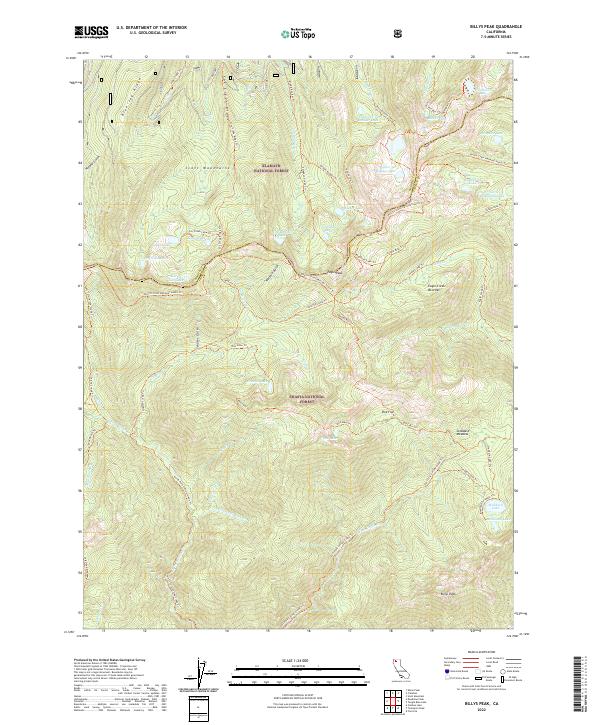
2022 Map of Billys Peak
USGS Topo · Published 2022About this map
The Scott Mountains dominate the high-elevation terrain where the borders of Klamath National Forest and Shasta National Forest meet. This survey provides a look at the intricate network of glacial basins and subalpine lakes that define this section of the Trinity Alps. A primary artery for high-country travel, the Pacific Crest National Scenic Trl traverses the central ridges, passing beneath the shadow of Eagle Peak. The topography is marked by a high concentration of remote water bodies, from the cluster of Upper Boulder Lake, Middle Boulder Lake, and Lower Boulder Lake to the more isolated Telephone Lake and Washbasin Lake. Evidence of historic land use appears in features like Milk Ranch Cr, while the hydrology is shaped by the headwaters of the N Fork Coffee Cr and Granite Creek. These drainage patterns, including Schuler Gulch and Noland Gulch, have historically guided movement through this high mountain pass.
Find a feature on this map
78 named features on this map. Tap any name to fly to it.
Don’t see what you’re looking for? This feature index may not catch every label — zoom into the map to look around manually.
Map Details
Editions of this 2022 Billys Peak Map
This is the sole edition of this map. No revisions or reprints were ever made.
Other maps of this area

1886 · Shasta
USGS Topo · 1:250,000

1894 · Shasta
USGS Topo · 1:250,000

1923 · Sawyers Bar
USGS Topo · 1:125,000

1931 · Etna
USGS Topo · 1:96,000

1934 · Etna
USGS Topo · 1:125,000

1948 · Weed
USGS Topo · 1:250,000

1950 · Weed
USGS Topo · 1:250,000
1955 · Bonanza King
USGS Topo · 1:62,500
1955 · China Mountain
USGS Topo · 1:62,500

1955 · Etna
USGS Topo · 1:62,500