
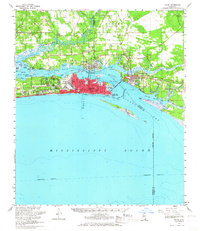
1954 Map of Biloxi
USGS Topo · Published 1962About this map
The Gulf Coast at Biloxi and Ocean Springs reveals a mid-century landscape defined by military presence and maritime life. The massive footprint of Keesler Air Force Base dominates the Biloxi peninsula, situated between the Back Bay of Biloxi and the Mississippi Sound. To the west, the Veterans Admin Center and development at Edgewater Park sit along the coast, while the Louisville and Nashville railroad provides the primary inland transit corridor.
Find a feature on this map
52 named features on this map. Tap any name to fly to it.
Don’t see what you’re looking for? This feature index may not catch every label — zoom into the map to look around manually.
Map Details
Editions of this 1954 Biloxi Map
2 editions found
Other maps of this area

1893 · Cat Island
USGS Topo · 1:62,500

1941 · Vancleave
USGS Topo · 1:62,500

1941 · Horn Island
USGS Topo · 1:62,500

1942 · Horn Island
USGS Topo · 1:62,500

1943 · Pascagoula
USGS Topo · 1:62,500

1943 · Vancleave
USGS Topo · 1:62,500

1944 · Vancleave
USGS Topo · 1:62,500

1950 · Dog Keys Pass
USGS Topo · 1:24,000

1950 · Ship Island
USGS Topo · 1:24,000

1951 · Cat Island
USGS Topo · 1:24,000