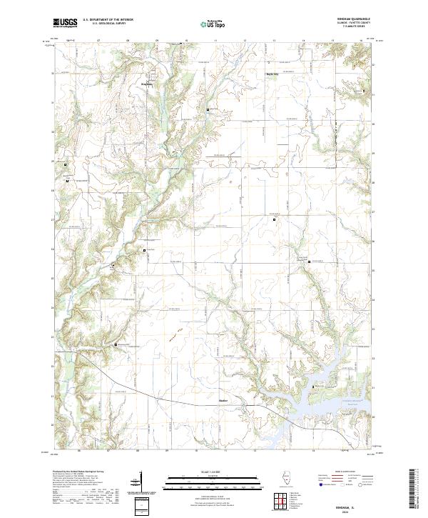
2024 Map of Bingham
USGS Topo · Published 2024About this map
Hurricane Creek and its winding tributaries define the rural landscape of northern Fayette County, where the village of Bingham serves as a central hub for the surrounding agricultural community. The terrain is notably dissected by watercourses like Liberty Creek and Panther Creek, which have shaped the placement of local thoroughfares and family-named cemeteries. To the east, the Vandalia Municipal Reservoir forms a significant body of water near the settlement of Shafter, contrasting with the upland farmsteads that characterize much of the area. This 2024 survey documents a network of rural roads that connect historic burial sites, including the Holy Cross Lutheran Cem and Monclovia Cem, providing a precise record of the regional geography as it exists today. The distribution of these small cemeteries and the persistence of settlements like Bayle City suggest a long-established pattern of local family landholdings and community centers throughout the township.
Find a feature on this map
72 named features on this map. Tap any name to fly to it.
Don’t see what you’re looking for? This feature index may not catch every label — zoom into the map to look around manually.
Map Details
Editions of this 2024 Bingham Map
This is the sole edition of this map. No revisions or reprints were ever made.
Other maps of this area

1932 · Greenville
USGS Topo · 1:62,500

1939 · Greenville
USGS Topo · 1:62,500

1943 · Greenville
USGS Topo · 1:62,500

1944 · Ramsey
USGS Topo · 1:62,500

1945 · Vandalia
USGS Topo · 1:62,500

1946 · Ramsey
USGS Topo · 1:62,500

1947 · Vandalia
USGS Topo · 1:62,500

1947 · Hillsboro
USGS Topo · 1:62,500

1949 · Hillsboro
USGS Topo · 1:62,500

1958 · Decatur
USGS Topo · 1:250,000