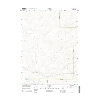
2014 Map of Bingham
USGS Topo · Published 2014About this map
Bingham serves as the primary hub in this portion of the Nebraska Sandhills, situated along the corridor of Ne-2. The map illustrates a landscape where cattle ranching and seasonal water bodies dictate the geography. Small lakes such as McCarty Lake, Anderson Lake, and Willy Lake dot the low-lying areas between complex dune formations. The transition between Sheridan, Garden, Grant, and Cherry counties occurs within these hills, marked by cattle trails and rural routes like 109th Trl and Road 205. The layout of Bingham is relatively compact, with local streets including Wilson Ave and 1st St branching off the highway near the southern border of Sheridan County. The broader terrain is defined by natural depressions like Larkin Valley, reflecting the specialized topography of this high-plains region.
Find a feature on this map
18 named features on this map. Tap any name to fly to it.
Don’t see what you’re looking for? This feature index may not catch every label — zoom into the map to look around manually.
Map Details
Editions of this 2014 Bingham Map
This is the sole edition of this map. No revisions or reprints were ever made.
Other maps of this area

1948 · Ashby
USGS Topo · 1:62,500

1948 · Bingham
USGS Topo · 1:62,500

1948 · George Lake
USGS Topo · 1:62,500

1949 · Ashby
USGS Topo · 1:62,500

1950 · George Lake
USGS Topo · 1:62,500

1950 · Longfellow Lake
USGS Topo · 1:62,500

1950 · Bingham
USGS Topo · 1:62,500

1954 · Scottsbluff
USGS Topo · 1:250,000

1954 · North Platte
USGS Topo · 1:250,000

1955 · Alliance
USGS Topo · 1:250,000