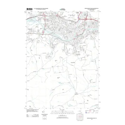
2013 Map of Binghamton West
USGS Topo · Published 2013About this map
The Susquehanna River and Chenango River converge near the heart of this urban and rural landscape, defining the industrial and civic development of the region. Local infrastructure is highlighted by the Binghamton Water Works and the Johnson City Water Works, while the Norfolk Southern railroad tracks follow the river's path, serving the riverside settlements of Westover and Sunrise Terrace. Historically significant burial grounds, including Floral Park Cem, Glenwood Cem, and Spring Forest Cem, are densely clustered near the riverbank, providing a wealth of information for genealogical research.
Find a feature on this map
72 named features on this map. Tap any name to fly to it.
Don’t see what you’re looking for? This feature index may not catch every label — zoom into the map to look around manually.
Map Details
Editions of this 2013 Binghamton West Map
This is the sole edition of this map. No revisions or reprints were ever made.
Other maps of this area

1901 · Apalachin
USGS Topo · 1:62,500

1904 · Binghamton
USGS Topo · 1:62,500

1904 · Apalachin
USGS Topo · 1:62,500

1906 · Catatonk
USGS Topo · 1:125,000

1934 · Castle Creek
USGS Topo · 1:24,000

1935 · Binghamton West
USGS Topo · 1:24,000

1935 · Chenango Forks
USGS Topo · 1:24,000

1937 · Binghamton East
USGS Topo · 1:24,000

1942 · Binghamton West
USGS Topo · 1:31,680

1942 · Castle Creek
USGS Topo · 1:31,680