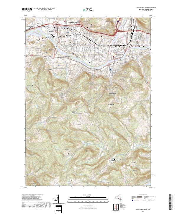
2023 Map of Binghamton West
USGS Topo · Published 2023About this map
The Susquehanna River and Chenango River converge in this detailed modern record of the Tri-Cities region, showing the intensive development of Binghamton, Johnson City, and Endwell. The landscape is defined by its transition from the dense urban core around the Broome County Courthouse to the expansive campus of Binghamton University and the residential neighborhoods of Westover and Park Terrace.
Find a feature on this map
126 named features on this map. Tap any name to fly to it.
Don’t see what you’re looking for? This feature index may not catch every label — zoom into the map to look around manually.
Map Details
Editions of this 2023 Binghamton West Map
This is the sole edition of this map. No revisions or reprints were ever made.
Other maps of this area

1901 · Apalachin
USGS Topo · 1:62,500

1904 · Binghamton
USGS Topo · 1:62,500

1904 · Apalachin
USGS Topo · 1:62,500

1906 · Catatonk
USGS Topo · 1:125,000

1934 · Castle Creek
USGS Topo · 1:24,000

1935 · Binghamton West
USGS Topo · 1:24,000

1935 · Chenango Forks
USGS Topo · 1:24,000

1937 · Binghamton East
USGS Topo · 1:24,000

1942 · Binghamton West
USGS Topo · 1:31,680

1942 · Castle Creek
USGS Topo · 1:31,680