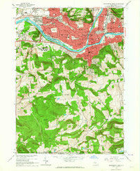
1961 Map of Binghamton West
USGS Topo · Published 1964About this map
Binghamton and Johnson City anchor this 1961 survey, where the confluence of the Susquehanna River and Chenango River shapes the urban layout. The industrial and educational character of the region is evident in the sprawling grounds of Harpur College and institutions like Lourdes Hospital and St Marys Orphan Home. The Erie-Lackawanna railroad tracks cut through the valley, highlighting the transit corridors that fueled the city's growth.
Find a feature on this map
83 named features on this map. Tap any name to fly to it.
Don’t see what you’re looking for? This feature index may not catch every label — zoom into the map to look around manually.
Map Details
Editions of this 1961 Binghamton West Map
This is the sole edition of this map. No revisions or reprints were ever made.
Other maps of this area

1901 · Apalachin
USGS Topo · 1:62,500

1904 · Binghamton
USGS Topo · 1:62,500

1904 · Apalachin
USGS Topo · 1:62,500

1906 · Catatonk
USGS Topo · 1:125,000

1934 · Castle Creek
USGS Topo · 1:24,000

1935 · Binghamton West
USGS Topo · 1:24,000

1935 · Chenango Forks
USGS Topo · 1:24,000

1937 · Binghamton East
USGS Topo · 1:24,000

1942 · Binghamton West
USGS Topo · 1:31,680

1942 · Castle Creek
USGS Topo · 1:31,680