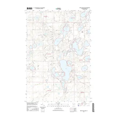
2015 Map of Birch Island Lake
USGS Topo · Published 2015About this map
Glacial kettle lakes and dense marshlands define this portion of Burnett County, where the intricate shoreline of Birch Island Lake and the expansive Sand Lake dominate the landscape. The area is characterized by a high concentration of water bodies, including Des Moines Lake and Cadotte Lake, interspersed with named wetlands like Kilkare Marsh. This 2015 survey reveals a pattern of recreational and rural development, notably seen at the Voyager Village Airstrip and the network of forest lanes such as Loon Lake Dam Ln and Thorton Fire LN. Genealogists and local historians can locate the Jackson Cem near Point Lake, situated among the township lines of t40n r15w and t40n r14w. The map preserves the complex layout of the region's hydrography and the modest infrastructure built around it during the early 21st century.
Find a feature on this map
128 named features on this map. Tap any name to fly to it.
Don’t see what you’re looking for? This feature index may not catch every label — zoom into the map to look around manually.
Map Details
Editions of this 2015 Birch Island Lake Map
This is the sole edition of this map. No revisions or reprints were ever made.
Other maps of this area

1949 · Danbury
USGS Topo · 1:48,000

1949 · Hertel
USGS Topo · 1:48,000

1949 · Webb Lake
USGS Topo · 1:48,000

1950 · Webster
USGS Topo · 1:48,000

1953 · Duluth
USGS Topo · 1:250,000

1953 · Stillwater
USGS Topo · 1:250,000

1955 · Hertel
USGS Topo · 1:62,500

1955 · Webb Lake
USGS Topo · 1:62,500

1955 · Webster
USGS Topo · 1:62,500

1955 · Stillwater
USGS Topo · 1:250,000