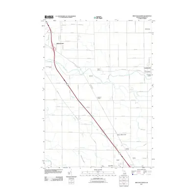
2011 Map of Birch Run North
USGS Topo · Published 2011About this map
Frankenmuth and Bridgeport anchor this survey of the Saginaw County landscape, where the Cass River winds through a patchwork of agricultural lands and residential growth. This 2011 record preserves the exact locations of numerous historic burial sites, including the Campau Family Cemetery and the Saint Lorenz's Evangelical Lutheran Cemetery, which speak to the area's deep-rooted settlement history. The transport corridor is dominated by the Dixie Hwy and the interstate, serving local landmarks like the Dixie Motor Speedway and Winter's Motor Court. Water management is evident through an extensive system of agricultural drainage, including the Zehender Drain and English Drain, while the Birch Run Oil Field in the south points to the region's diverse economic activities. From the aviation facilities at Mc Kimmy Field Airport to the greens of the Green Acres Golf Course, the map detail provides a clear look at the contemporary infrastructure of these Michigan townships.
Find a feature on this map
77 named features on this map. Tap any name to fly to it.
Don’t see what you’re looking for? This feature index may not catch every label — zoom into the map to look around manually.
Map Details
Editions of this 2011 Birch Run North Map
This is the sole edition of this map. No revisions or reprints were ever made.
Other maps of this area

1919 · Saginaw
USGS Topo · 1:62,500

1919 · Burt
USGS Topo · 1:62,500

1920 · Flint
USGS Topo · 1:62,500

1921 · Burt
USGS Topo · 1:62,500

1922 · Flint
USGS Topo · 1:62,500

1941 · Saginaw
USGS Topo · 1:62,500

1943 · Burt
USGS Topo · 1:62,500

1943 · Saginaw
USGS Topo · 1:62,500

1943 · Flint
USGS Topo · 1:62,500

1954 · Flint
USGS Topo · 1:250,000
Featured Places
- City of Frankenmuth, MI
- Birch Run, MI
- Bridgeport Charter Township, MI
- Taymouth Township, MI
- Birch Run Township, MI