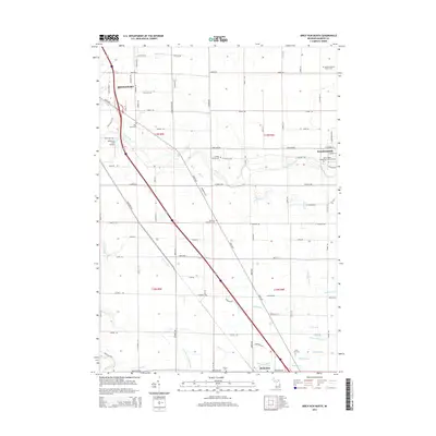
2014 Map of Birch Run North
USGS Topo · Published 2014About this map
The Cass River and Flint River watersheds define this part of Saginaw County, where the agricultural landscape is crisscrossed by an extensive network of man-made drainage systems. The map details numerous specific watercourses including Zehender Drain, Runnels Drain, and Hutchinson and Young Drain, illustrating the complex water management required for the region's productive farmland. The area between Bridgeport and Birch Run is dotted with several significant burial grounds that reflect the local heritage, such as Saint Lorenz's Evangelical Lutheran Cem and the Campau Family Cem. Small-scale aviation is represented by McKimmy Field Airport near the northern edge, while the transit corridor follows the Dixie Hwy, linking the dispersed rural settlements and family cemeteries that characterize this mid-Michigan territory.
Find a feature on this map
87 named features on this map. Tap any name to fly to it.
Don’t see what you’re looking for? This feature index may not catch every label — zoom into the map to look around manually.
Map Details
Editions of this 2014 Birch Run North Map
This is the sole edition of this map. No revisions or reprints were ever made.
Other maps of this area

1919 · Saginaw
USGS Topo · 1:62,500

1919 · Burt
USGS Topo · 1:62,500

1920 · Flint
USGS Topo · 1:62,500

1921 · Burt
USGS Topo · 1:62,500

1922 · Flint
USGS Topo · 1:62,500

1941 · Saginaw
USGS Topo · 1:62,500

1943 · Burt
USGS Topo · 1:62,500

1943 · Saginaw
USGS Topo · 1:62,500

1943 · Flint
USGS Topo · 1:62,500

1954 · Flint
USGS Topo · 1:250,000
Featured Places
- City of Frankenmuth, MI
- Birch Run, MI
- Bridgeport Charter Township, MI
- Taymouth Township, MI
- Birch Run Township, MI