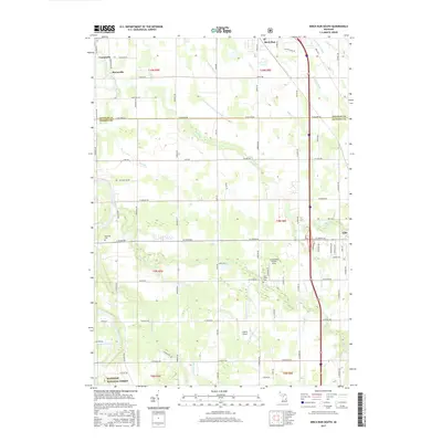
2017 Map of Birch Run South
USGS Topo · Published 2017About this map
The Flint River meanders through the northwest corner of this region, passing the small settlements of Taymouth and Morseville as they appeared in the late 2010s. This agricultural landscape, straddling the border of Saginaw and Genesee Counties, is defined by an extensive network of drainage systems such as the Alexander Drain, Silver Cr Drain, and Bogart Drain, which manage the low-lying terrain for farming. The map highlights the contrast between the organized township grids and the serpentine paths of natural waterways like Pine Run and Silver Cr.
Find a feature on this map
80 named features on this map. Tap any name to fly to it.
Don’t see what you’re looking for? This feature index may not catch every label — zoom into the map to look around manually.
Map Details
Editions of this 2017 Birch Run South Map
This is the sole edition of this map. No revisions or reprints were ever made.
Other maps of this area

1919 · Saginaw
USGS Topo · 1:62,500

1919 · Burt
USGS Topo · 1:62,500

1920 · Flint
USGS Topo · 1:62,500

1921 · Burt
USGS Topo · 1:62,500

1922 · Flint
USGS Topo · 1:62,500

1941 · Saginaw
USGS Topo · 1:62,500

1943 · Burt
USGS Topo · 1:62,500

1943 · Saginaw
USGS Topo · 1:62,500

1943 · Flint
USGS Topo · 1:62,500

1954 · Flint
USGS Topo · 1:250,000