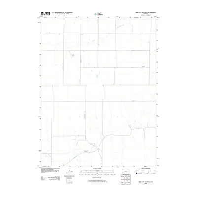
2009 Map of Bird City South SE
USGS Topo · Published 2009About this map
Beaver Creek and its tributary, Little Beaver Creek, carve a subtle drainage pattern across this section of the High Plains in Sherman County. The landscape is defined by the rigid grid of the Public Land Survey System, with local transportation corridors like Co RD 27 and Co RD B following section lines through the agricultural terrain. This 2009 survey highlights a rural environment where history is preserved in small, localized sites rather than large urban centers. For genealogists and local historians, the map provides precise locations for Sunnyside Cemetery in the northeast and Shermanville Cemetery to the south. The presence of Bursch Airport indicates the continued importance of general aviation in supporting the remote ranching and farming operations of western Kansas.
Find a feature on this map
15 named features on this map. Tap any name to fly to it.
Don’t see what you’re looking for? This feature index may not catch every label — zoom into the map to look around manually.
Map Details
Editions of this 2009 Bird City South SE Map
This is the sole edition of this map. No revisions or reprints were ever made.
Other maps of this area

1951 · Bird City South
USGS Topo · 1:62,500

1951 · Dewey Ranch
USGS Topo · 1:62,500

1954 · Goodland
USGS Topo · 1:250,000

1956 · Goodland
USGS Topo · 1:250,000

1957 · Goodland
USGS Topo · 1:250,000

1966 · Goodland NW
USGS Topo · 1:24,000

1966 · Goodland NE
USGS Topo · 1:24,000

1966 · Brewster NW
USGS Topo · 1:24,000
1981 · Bird City South NW
USGS Topo · 1:24,000
1981 · Dewey Ranch SW
USGS Topo · 1:24,000