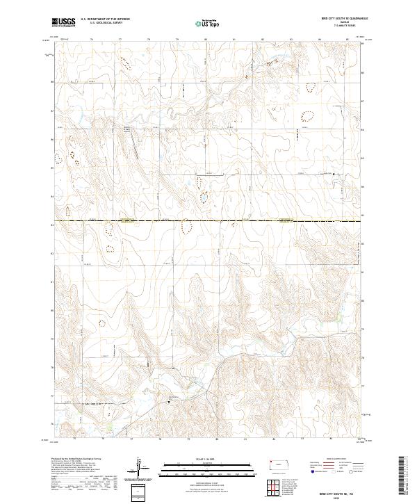
2022 Map of Bird City South SE
USGS Topo · Published 2022About this map
Shermanville Cem sits on the high ground above the winding drainage of Beaver Cr, marking a quiet corner of the High Plains where the Cheyenne and Sherman county line divides the landscape. This part of western Kansas is defined by a sparse network of section-line roads like Co RD 80 and Co RD 79, which navigate a terrain carved by intermittent watercourses. To the north, Sunnyside Cem and the Bursch Private Airport provide rare vertical landmarks in a region dominated by wide horizons and agricultural rhythm. The distinct drainage patterns of Little Beaver Cr illustrate the subtle topography that dictated the placement of early settlements and rural crossroads in this high prairie environment.
Find a feature on this map
18 named features on this map. Tap any name to fly to it.
Don’t see what you’re looking for? This feature index may not catch every label — zoom into the map to look around manually.
Map Details
Editions of this 2022 Bird City South SE Map
This is the sole edition of this map. No revisions or reprints were ever made.
Other maps of this area

1951 · Bird City South
USGS Topo · 1:62,500

1951 · Dewey Ranch
USGS Topo · 1:62,500

1954 · Goodland
USGS Topo · 1:250,000

1956 · Goodland
USGS Topo · 1:250,000

1957 · Goodland
USGS Topo · 1:250,000

1966 · Goodland NW
USGS Topo · 1:24,000

1966 · Goodland NE
USGS Topo · 1:24,000

1966 · Brewster NW
USGS Topo · 1:24,000
1981 · Bird City South NW
USGS Topo · 1:24,000
1981 · Dewey Ranch SW
USGS Topo · 1:24,000