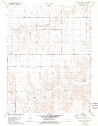
1981 Map of Bird City South SE
USGS Topo · Published 1981About this map
Beaver Creek and Little Beaver Creek wind through the high plains of northwest Kansas, shaping the topography across the Cheyenne Co Sherman Co line. This early 1980s survey reflects a region primarily defined by ranching and agricultural infrastructure, evidenced by the numerous marked Wells that dot the section lines. The settlement of Kehlbeck stands near the center of the sheet, while the southern portion is categorized by the historical township areas of Voltaire, Shermanville, and Llanos. Industrial and transport features include the Sandpits located along the southern creek bed and the Bursch Landing Strip further north. For those researching local burial sites, the Sunnyside Cem is clearly marked in the eastern portion of the Cheyenne County section, providing a vital point for genealogical study in this sparsely populated landscape.
Find a feature on this map
11 named features on this map. Tap any name to fly to it.
Don’t see what you’re looking for? This feature index may not catch every label — zoom into the map to look around manually.
Map Details
Editions of this 1981 Bird City South SE Map
This is the sole edition of this map. No revisions or reprints were ever made.
Other maps of this area

1951 · Bird City South
USGS Topo · 1:62,500

1951 · Dewey Ranch
USGS Topo · 1:62,500

1954 · Goodland
USGS Topo · 1:250,000

1956 · Goodland
USGS Topo · 1:250,000

1957 · Goodland
USGS Topo · 1:250,000

1966 · Goodland NW
USGS Topo · 1:24,000

1966 · Goodland NE
USGS Topo · 1:24,000

1966 · Brewster NW
USGS Topo · 1:24,000
1981 · Bird City South NW
USGS Topo · 1:24,000
1981 · Dewey Ranch SW
USGS Topo · 1:24,000