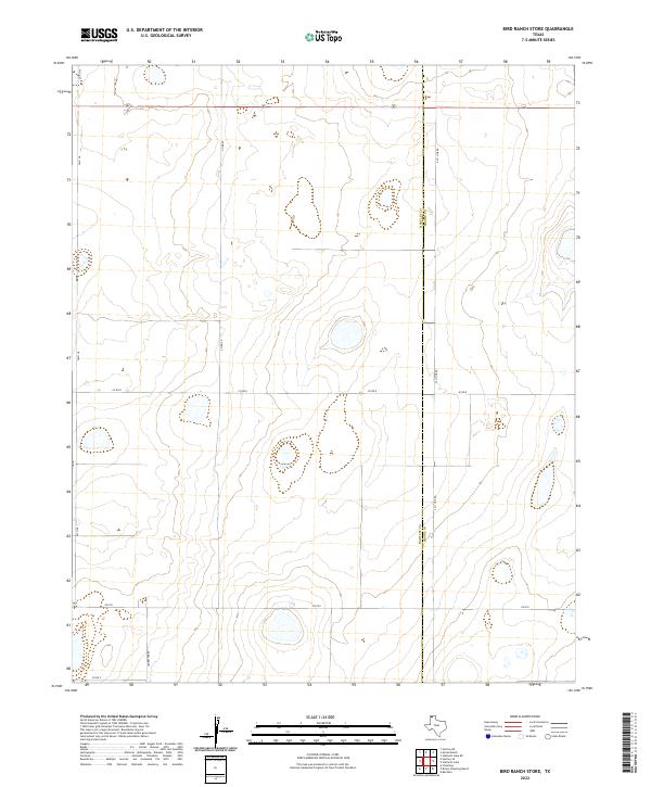
2022 Map of Bird Ranch Store
USGS Topo · Published 2022About this map
The county boundary between Hartley Co and Moore Co bisects this high plains landscape, defining the administrative and social divisions of the Texas Panhandle. The area is characterized by a sparse, rhythmic grid of section lines and ranch roads, reflecting the large-scale cattle and agricultural operations of the region. Local travel is facilitated by North-South corridors like FM 3138 and Co RD 49, which intersect with primary East-West routes including FM 722 and Co RD R. This infrastructure reveals a landscape built for heavy logistics and long-distance connectivity between isolated ranching headquarters. Named landmarks like Ledbetter Rd and the intersection at S Co Line Rd provide specific geographic anchors for researchers tracing the development of land use and family holdings in these two bordering counties.
Find a feature on this map
11 named features on this map. Tap any name to fly to it.
Don’t see what you’re looking for? This feature index may not catch every label — zoom into the map to look around manually.
Map Details
Editions of this 2022 Bird Ranch Store Map
This is the sole edition of this map. No revisions or reprints were ever made.
Other maps of this area

1954 · Tucumcari
USGS Topo · 1:250,000

1958 · Tucumcari
USGS Topo · 1:250,000

1963 · Hartley SE
USGS Topo · 1:24,000

1963 · Hartley NE
USGS Topo · 1:24,000

1963 · Bird Ranch Store
USGS Topo · 1:24,000

1963 · Stallwitz Lake
USGS Topo · 1:24,000

1963 · Moran Ranch
USGS Topo · 1:24,000
1965 · Stallwitz Lake NE
USGS Topo · 1:24,000

1971 · Bivins Channing Ranch
USGS Topo · 1:24,000
1971 · Bautista
USGS Topo · 1:24,000