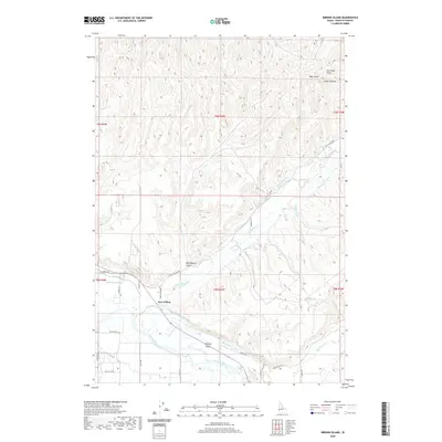
2020 Map of Birding Island
USGS Topo · Published 2020About this map
The Payette River corridor in Payette County defines this landscape, where complex irrigation systems support the local agricultural economy. Features like the Lower Payette Ditch, Bolton Canal, and Patton Canal crisscross the lowlands near the river, illustrating the vital role of water management in this arid region. The settlement of Fort Wilson and the namesake Birding Island sit amidst a network of drainage and supply lines including Big Willow Creek and the Forty-nine Slough. To the north, the terrain transitions into a series of dissected ridges and canyons, marked by landmarks such as Rock Quarry Gulch, Tucker Canyon, and Clair Rose Gulch. This 2020 survey provides a modern view of how historic land divisions and water rights continue to shape the geography of the western Snake River Plain.
Find a feature on this map
35 named features on this map. Tap any name to fly to it.
Don’t see what you’re looking for? This feature index may not catch every label — zoom into the map to look around manually.
Map Details
Editions of this 2020 Birding Island Map
This is the sole edition of this map. No revisions or reprints were ever made.
Other maps of this area

1897 · Weiser
USGS Topo · 1:125,000

1898 · Nampa
USGS Topo · 1:125,000

1951 · Payette
USGS Topo · 1:24,000

1951 · Weiser South
USGS Topo · 1:24,000

1952 · Weiser Cove
USGS Topo · 1:24,000

1952 · Birding Island
USGS Topo · 1:24,000

1955 · Baker
USGS Topo · 1:250,000

1955 · Boise
USGS Topo · 1:250,000

1958 · Boise
USGS Topo · 1:250,000

1959 · Baker
USGS Topo · 1:250,000