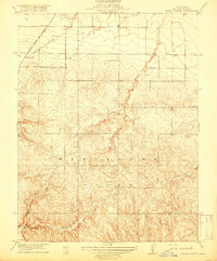
1918 Map of Birds Landing
USGS Topo · Published 1918About this map
The Montezuma Hills dominate this landscape, showcasing a complex series of ridges and drainages during a period of agricultural and transit expansion in Solano County. At the southern edge of the survey, the settlement of Birds Landing sits near Lucol 3 Hollow, serving as a focal point for local commerce and rural life. The topography reflects the intricate network of ravines and hills that defined the region before modern development reshaped much of the northern California delta hinterlands.
Find a feature on this map
10 named features on this map. Tap any name to fly to it.
Don’t see what you’re looking for? This feature index may not catch every label — zoom into the map to look around manually.
Map Details
Editions of this 1918 Birds Landing Map
2 editions found
Other maps of this area

1907 · Antioch
USGS Topo · 1:62,500

1908 · Vacaville
USGS Topo · 1:62,500

1908 · Courtland
USGS Topo · 1:62,500

1908 · Antioch
USGS Topo · 1:62,500

1910 · Rio Vista
USGS Topo · 1:31,680

1910 · Jersey
USGS Topo · 1:31,680

1916 · Cache Slough
USGS Topo · 1:31,680

1916 · Maine Prairie
USGS Topo · 1:31,680

1917 · Elmira
USGS Topo · 1:31,680

1918 · Honker Bay
USGS Topo · 1:31,680