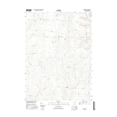
2016 Map of Birdsall
USGS Topo · Published 2016About this map
Birdsall serves as the central hub of this Allegany County landscape, where the topography is defined by the significant rise of Grunder Hill and the winding course of the Canisteo River. The mapping reveals a rural architecture of long-established community pockets, evidenced by several distinct burial grounds including the Weaver Settlement Cem and the German Settlement Cem. These names, alongside roads like Dutch Settlement Rd, suggest the heritage of the early families who cleared and farmed these uplands.
Find a feature on this map
67 named features on this map. Tap any name to fly to it.
Don’t see what you’re looking for? This feature index may not catch every label — zoom into the map to look around manually.
Map Details
Editions of this 2016 Birdsall Map
This is the sole edition of this map. No revisions or reprints were ever made.
Other maps of this area

1905 · Portage
USGS Topo · 1:62,500

1905 · Nunda
USGS Topo · 1:62,500

1906 · Angelica
USGS Topo · 1:62,500

1916 · Canaseraga
USGS Topo · 1:62,500

1940 · Canaseraga
USGS Topo · 1:62,500

1941 · Angelica
USGS Topo · 1:62,500

1943 · Nunda
USGS Topo · 1:24,000

1943 · Ossian
USGS Topo · 1:24,000

1943 · Portageville
USGS Topo · 1:24,000
1944 · Nunda
USGS Topo · 1:31,680