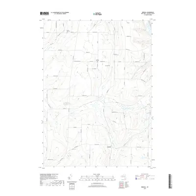
2019 Map of Birdsall
USGS Topo · Published 2019About this map
Birdsall serves as the central hub of this Allegany County landscape, where the headwaters of several significant drainages diverge. The terrain is defined by a high plateau dissected by numerous creeks, including the southward-flowing Baker Cr and Black Creek, which eventually reach the Canisteo River at the southern edge of the sheet. To the north, the land slopes toward Keshequa Cr and Rush Cr.
Find a feature on this map
69 named features on this map. Tap any name to fly to it.
Don’t see what you’re looking for? This feature index may not catch every label — zoom into the map to look around manually.
Map Details
Editions of this 2019 Birdsall Map
This is the sole edition of this map. No revisions or reprints were ever made.
Other maps of this area

1905 · Portage
USGS Topo · 1:62,500

1905 · Nunda
USGS Topo · 1:62,500

1906 · Angelica
USGS Topo · 1:62,500

1916 · Canaseraga
USGS Topo · 1:62,500

1940 · Canaseraga
USGS Topo · 1:62,500

1941 · Angelica
USGS Topo · 1:62,500

1943 · Nunda
USGS Topo · 1:24,000

1943 · Ossian
USGS Topo · 1:24,000

1943 · Portageville
USGS Topo · 1:24,000
1944 · Nunda
USGS Topo · 1:31,680