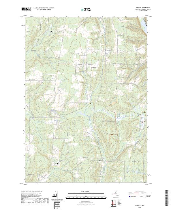
2023 Map of Birdsall
USGS Topo · Published 2023About this map
Birdsall serves as the central hub of this Allegany County landscape, where the terrain is defined by the high elevations of Grunder Hill and the drainage patterns of Black Creek. The area's mid-20th-century character is preserved through a network of rural roads such as Dutch Settlement Rd and Weaver Settlement Rd, which point to the historic ethnic enclaves that once populated these uplands. Significant water features like Jones Pond and the extensive Keaney Swamp dominate the lower valleys, providing a contrast to the family-named ridges and gullies.
Find a feature on this map
70 named features on this map. Tap any name to fly to it.
Don’t see what you’re looking for? This feature index may not catch every label — zoom into the map to look around manually.
Map Details
Editions of this 2023 Birdsall Map
This is the sole edition of this map. No revisions or reprints were ever made.
Other maps of this area

1905 · Portage
USGS Topo · 1:62,500

1905 · Nunda
USGS Topo · 1:62,500

1906 · Angelica
USGS Topo · 1:62,500

1916 · Canaseraga
USGS Topo · 1:62,500

1940 · Canaseraga
USGS Topo · 1:62,500

1941 · Angelica
USGS Topo · 1:62,500

1943 · Nunda
USGS Topo · 1:24,000

1943 · Ossian
USGS Topo · 1:24,000

1943 · Portageville
USGS Topo · 1:24,000
1944 · Nunda
USGS Topo · 1:31,680