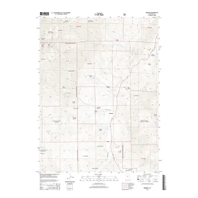
2014 Map of Birdseye
USGS Topo · Published 2014About this map
The settlement of Birdseye sits at the heart of this landscape, positioned along the corridor where Thistle Cr flows toward the north. This high-elevation terrain is defined by the steep rises of the Wasatch Range, anchored by the massive profiles of Loafer Mtn and Santaquin Peak in the northwest. The map documents a complex network of canyons and hollows, including Wildcat Canyon and Mud Hollow, that drain the surrounding highlands of the Uinta National Forest and Manti-Lasal National Forest. Local infrastructure is concentrated along Us-89, which connects small locales like Pines and the resource-named Asphaltum. Genealogical and local history interest is found in specific landmarks such as Nielson Knoll and the water sources like Peery Mill Spring and Cottonwood Spring that supported early ranching or settlement efforts in these mountain valleys.
Find a feature on this map
93 named features on this map. Tap any name to fly to it.
Don’t see what you’re looking for? This feature index may not catch every label — zoom into the map to look around manually.
Map Details
Editions of this 2014 Birdseye Map
This is the sole edition of this map. No revisions or reprints were ever made.
Other maps of this area

1885 · Salt Lake
USGS Topo · 1:250,000

1885 · Manti
USGS Topo · 1:250,000

1895 · Manti
USGS Topo · 1:250,000

1907 · Strawberry Valley
USGS Topo · 1:125,000

1909 · Strawberry Valley
USGS Topo · 1:125,000

1948 · Spanish Fork
USGS Topo · 1:24,000

1949 · Provo
USGS Topo · 1:62,500

1949 · Spanish Fork Peak
USGS Topo · 1:24,000

1950 · Spanish Fork
USGS Topo · 1:24,000

1951 · Spanish Fork Peak
USGS Topo · 1:24,000