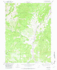
1979 Map of Birdseye
USGS Topo · Published 1979About this map
Thistle Creek carves a narrow north-south corridor through the high country of Central Utah, serving as the primary passage for both the Denver and Rio Grande Western railroad and Highway 89. This 1970s survey captures the region just before the massive 1983 landslide that would fundamentally alter this canyon landscape. The settlement of Birdseye sits near the center of the sheet, supported by local industry like the Birdseye Quarry and historical resource sites like Asphaltum (Site) to the north.
Find a feature on this map
53 named features on this map. Tap any name to fly to it.
Don’t see what you’re looking for? This feature index may not catch every label — zoom into the map to look around manually.
Map Details
Editions of this 1979 Birdseye Map
This is the sole edition of this map. No revisions or reprints were ever made.
Other maps of this area

1885 · Salt Lake
USGS Topo · 1:250,000

1885 · Manti
USGS Topo · 1:250,000

1895 · Manti
USGS Topo · 1:250,000

1907 · Strawberry Valley
USGS Topo · 1:125,000

1909 · Strawberry Valley
USGS Topo · 1:125,000

1948 · Spanish Fork
USGS Topo · 1:24,000

1949 · Provo
USGS Topo · 1:62,500

1949 · Spanish Fork Peak
USGS Topo · 1:24,000

1950 · Spanish Fork
USGS Topo · 1:24,000

1951 · Spanish Fork Peak
USGS Topo · 1:24,000