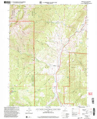
2001 Map of Birdseye
USGS Topo · Published 2004About this map
Thistle Creek carves a central corridor through this southern Utah County landscape, dividing the high ridges of the Uinta National Forest from the Manti La Sal National Forest. The settlement of Birdseye serves as a focal point along the valley floor, accompanied by smaller locales such as Pines and Cox further south. This 2001 revision illustrates a region shaped by natural resource extraction and conservation, evidenced by the Birdseye Quarry and the historic Asphaltum (Site) near the eastern boundary. The terrain is defined by a dense network of drainages including Hyle Hollow and Hudson Hollow, which feed into the primary creek system. On the western heights, the Loafer Mountain State Wildlife Management Area protects the rugged slopes of Loafer Mountain, while lower elevations show infrastructure like Communication Towers and a significant Pipeline traversing the foothills near Pearl Mill Spring.
Find a feature on this map
60 named features on this map. Tap any name to fly to it.
Don’t see what you’re looking for? This feature index may not catch every label — zoom into the map to look around manually.
Map Details
Editions of this 2001 Birdseye Map
This is the sole edition of this map. No revisions or reprints were ever made.
Other maps of this area

1885 · Salt Lake
USGS Topo · 1:250,000

1885 · Manti
USGS Topo · 1:250,000

1895 · Manti
USGS Topo · 1:250,000

1907 · Strawberry Valley
USGS Topo · 1:125,000

1909 · Strawberry Valley
USGS Topo · 1:125,000

1948 · Spanish Fork
USGS Topo · 1:24,000

1949 · Provo
USGS Topo · 1:62,500

1949 · Spanish Fork Peak
USGS Topo · 1:24,000

1950 · Spanish Fork
USGS Topo · 1:24,000

1951 · Spanish Fork Peak
USGS Topo · 1:24,000