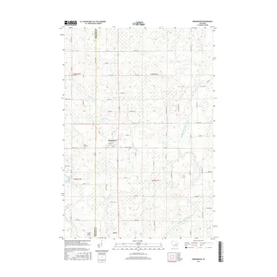
2015 Map of Birnamwood
USGS Topo · Published 2015About this map
The village of Birnamwood straddles the border of Marathon and Shawano counties, serving as a focal point for this rural Wisconsin landscape. To the south lies the settlement of Eland, connected by a network of local roads such as Birnamwood Rd and Co RD N. The area's history is preserved at the Saint Philomene Cem and the CO HWY N Forest Cem, providing valuable touchpoints for genealogists. Low-lying terrain and local hydrology are prominent features, with the Mattoon Swamp and the winding course of the Middle Branch Embarrass River shaping the environment. Smaller water bodies like Mud Lake, Mayflower Lake, and Packard Cr dot the countryside, while the Norrie Brook Airport provides a modern navigational landmark near Norrie Brook. This topographical layout illustrates the persistent intersection of timberland-inflected geography and small-town development in the north-central part of the state.
Find a feature on this map
74 named features on this map. Tap any name to fly to it.
Don’t see what you’re looking for? This feature index may not catch every label — zoom into the map to look around manually.
Map Details
Editions of this 2015 Birnamwood Map
This is the sole edition of this map. No revisions or reprints were ever made.
Other maps of this area

1899 · Wausau
USGS Topo · 1:125,000

1902 · Wausau
USGS Topo · 1:125,000

1951 · Doering
USGS Topo · 1:48,000

1952 · Antigo
USGS Topo · 1:48,000

1953 · Hatley
USGS Topo · 1:48,000

1954 · Wittenberg
USGS Topo · 1:48,000

1954 · Iron Mountain
USGS Topo · 1:250,000

1955 · Green Bay
USGS Topo · 1:250,000

1959 · Iron Mountain
USGS Topo · 1:250,000

1964 · Wittenberg
USGS Topo · 1:62,500