
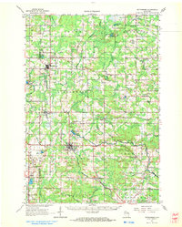
1964 Map of Wittenberg
USGS Topo · Published 1965About this map
The Embarrass River and its multiple branches define the drainage of this central Wisconsin landscape, which sits along the border of Marathon and Shawano counties. During the mid-1960s, the village of Wittenberg served as a regional hub, notably housing the Homme Home for Boys near Homme Pond. The area's settlement pattern is closely tied to the Chicago and North Western railway, which connects several smaller communities including Eland, Birnamwood, and Mattoon.
Find a feature on this map
60 named features on this map. Tap any name to fly to it.
Don’t see what you’re looking for? This feature index may not catch every label — zoom into the map to look around manually.
Map Details
Editions of this 1964 Wittenberg Map
2 editions found
Other maps of this area

1899 · Wausau
USGS Topo · 1:125,000

1902 · Wausau
USGS Topo · 1:125,000

1951 · Doering
USGS Topo · 1:48,000

1952 · Antigo
USGS Topo · 1:48,000

1952 · White Lake
USGS Topo · 1:48,000

1953 · Hatley
USGS Topo · 1:48,000

1954 · Wittenberg
USGS Topo · 1:48,000

1954 · Gresham
USGS Topo · 1:48,000

1954 · Iron Mountain
USGS Topo · 1:250,000

1955 · Clintonville
USGS Topo · 1:48,000