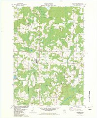
1982 Map of Birnamwood
USGS Topo · Published 1982About this map
Birnamwood serves as the central hub of this 1982 landscape straddling the Marathon Co Shawano Co line. The village is defined by its position along the Chicago and North Western railroad, which runs south toward the corporate boundary of Eland. This survey captures the rural character of the region through its religious and civic sites, including St Philomena Cem and the Townhall located near the intersection of Townline Road and Phoebe Road.
Find a feature on this map
41 named features on this map. Tap any name to fly to it.
Don’t see what you’re looking for? This feature index may not catch every label — zoom into the map to look around manually.
Map Details
Editions of this 1982 Birnamwood Map
This is the sole edition of this map. No revisions or reprints were ever made.
Other maps of this area

1899 · Wausau
USGS Topo · 1:125,000

1902 · Wausau
USGS Topo · 1:125,000

1951 · Doering
USGS Topo · 1:48,000

1952 · Antigo
USGS Topo · 1:48,000

1953 · Hatley
USGS Topo · 1:48,000

1954 · Wittenberg
USGS Topo · 1:48,000

1954 · Iron Mountain
USGS Topo · 1:250,000

1955 · Green Bay
USGS Topo · 1:250,000

1959 · Iron Mountain
USGS Topo · 1:250,000

1964 · Wittenberg
USGS Topo · 1:62,500