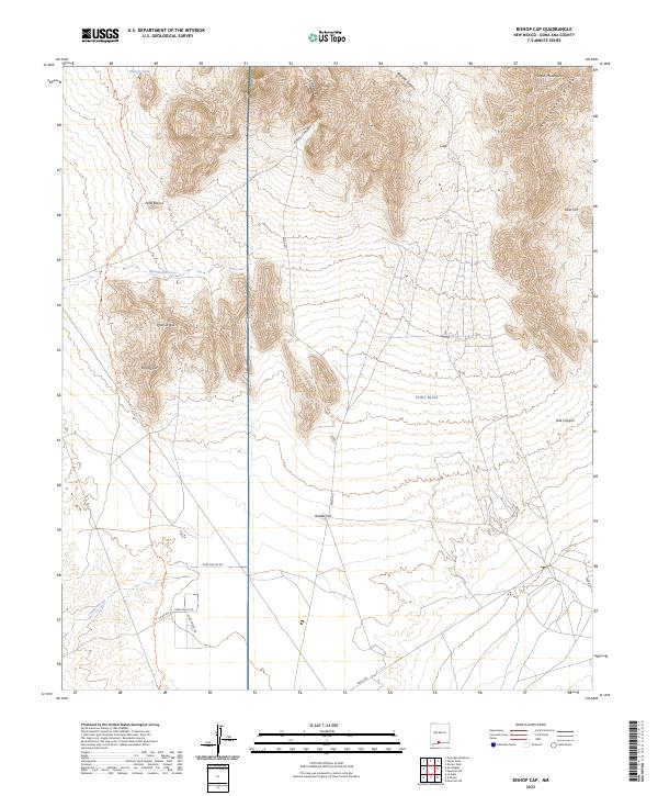
2023 Map of Bishop Cap
USGS Topo · Published 2023About this map
Organ Mountains-Desert Peaks National Monument dominates the western half of this landscape, where the Chihuahuan Desert meets sharp uplifted peaks. High-elevation landmarks like Bishop Cap and Pyramid Peak provide dramatic relief above the surrounding basins, while the rugged northern reach is defined by the Organ Mountains and Rattlesnake Ridge. This area serves as a critical buffer between public protected lands and the military boundaries of Fort Bliss, which occupies the eastern section of the quadrangle.
Find a feature on this map
27 named features on this map. Tap any name to fly to it.
Don’t see what you’re looking for? This feature index may not catch every label — zoom into the map to look around manually.
Map Details
Editions of this 2023 Bishop Cap Map
This is the sole edition of this map. No revisions or reprints were ever made.
Other maps of this area

1891 · Las Cruces
USGS Topo · 1:125,000

1893 · Las Cruces
USGS Topo · 1:125,000

1940 · Newman
USGS Topo · 1:62,500

1941 · Organ Peak
USGS Topo · 1:62,500

1943 · La Mesa
USGS Topo · 1:62,500

1943 · Parker Lake
USGS Topo · 1:62,500

1943 · Newman
USGS Topo · 1:62,500

1943 · Organ Peak
USGS Topo · 1:62,500

1948 · Davies Tank
USGS Topo · 1:24,000

1948 · Newman NW
USGS Topo · 1:24,000