
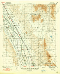
1943 Map of La Mesa
USGS Topo · Published 1943About this map
The Mesilla Valley dominates this 1941 survey, showing a landscape defined by an intricate network of irrigation and drainage that supported the region's agricultural colonies. The Rio Grande is flanked by the West Side Canal and the Chamberino Drainage Canal, reflecting the massive engineering efforts required to manage water in the high desert. Settlement patterns follow the river and the Atchison Topeka and Santa Fe Railway, with towns like Vado and Mesquite serving as transit points for local produce.
Find a feature on this map
52 named features on this map. Tap any name to fly to it.
Don’t see what you’re looking for? This feature index may not catch every label — zoom into the map to look around manually.
Map Details
Editions of this 1943 La Mesa Map
2 editions found
Other maps of this area

1891 · Las Cruces
USGS Topo · 1:125,000

1893 · Las Cruces
USGS Topo · 1:125,000

1896 · El Paso
USGS Topo · 1:125,000

1908 · El Paso
USGS Topo · 1:125,000

1917 · Canutillo
USGS Topo · 1:62,500

1917 · Noria
USGS Topo · 1:62,500

1918 · Noria
USGS Topo · 1:62,500

1919 · Canutillo
USGS Topo · 1:62,500

1940 · Newman
USGS Topo · 1:62,500

1941 · Las Cruces
USGS Topo · 1:62,500