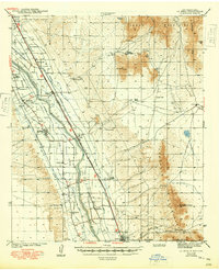
1943 Map of La Mesa
USGS Topo · Published 1949About this map
The Mesilla Valley is defined by a dense network of irrigation systems and agricultural colonies along the Rio Grande as it flows south toward the Texas border. Surveyed just before the mid-century, this landscape reveals a deeply structured rural society centered on the Atchison Topeka and Santa Fe railroad line. Small farming communities such as La Mesa, Berino, and Chamberino are surrounded by land grants and colonies like Doña Ana Bend Colony and Refugio Colony, reflecting the region's complex history of land tenure.
Find a feature on this map
56 named features on this map. Tap any name to fly to it.
Don’t see what you’re looking for? This feature index may not catch every label — zoom into the map to look around manually.
Map Details
Editions of this 1943 La Mesa Map
2 editions found

Other maps of this area

1891 · Las Cruces
USGS Topo · 1:125,000

1893 · Las Cruces
USGS Topo · 1:125,000

1896 · El Paso
USGS Topo · 1:125,000

1908 · El Paso
USGS Topo · 1:125,000

1917 · Canutillo
USGS Topo · 1:62,500

1917 · Noria
USGS Topo · 1:62,500

1918 · Noria
USGS Topo · 1:62,500

1919 · Canutillo
USGS Topo · 1:62,500

1940 · Newman
USGS Topo · 1:62,500

1941 · Las Cruces
USGS Topo · 1:62,500