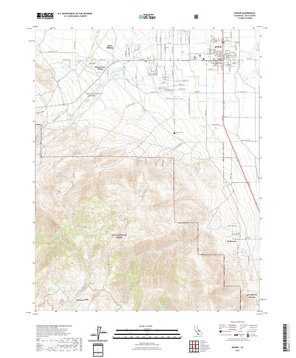
2021 Map of Bishop
USGS Topo · Published 2021About this map
The eastern slope of the Sierra Nevada meets the high desert floor in this 2021 survey of Bishop, California. This landscape is defined by the complex water management systems of the Owens Valley, where the Owens River Canal, Bishop Cr Canal, and Rawson Canal divert the flow of snowmelt streams like Bishop Cr and its northern and southern forks. To the west, the steep rise toward the Inyo National Forest is marked by landmarks like Peterson Mill and the expansive Coyote Flats, while the valley floor supports a series of residential clusters including West Bishop and Oteys Sierra Village. Local history is anchored by the Inyo County Superior Court and the Pioneer Cem downtown, contrasting with the thermal waters of Keough Hot Springs found further south along the highway corridor.
Find a feature on this map
96 named features on this map. Tap any name to fly to it.
Don’t see what you’re looking for? This feature index may not catch every label — zoom into the map to look around manually.
Map Details
Editions of this 2021 Bishop Map
This is the sole edition of this map. No revisions or reprints were ever made.
Other maps of this area

1912 · Mt. Goddard
USGS Topo · 1:125,000

1913 · Bishop
USGS Topo · 1:125,000

1947 · Mariposa
USGS Topo · 1:250,000

1948 · Mariposa
USGS Topo · 1:250,000

1948 · Mt. Goddard
USGS Topo · 1:62,500

1949 · Mt. Tom
USGS Topo · 1:62,500

1949 · Bishop
USGS Topo · 1:62,500

1950 · Big Pine
USGS Topo · 1:62,500

1951 · Mt. Tom
USGS Topo · 1:62,500

1951 · Mt. Goddard
USGS Topo · 1:62,500