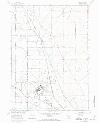
1960 Map of Bishop
USGS Topo · Published 1972About this map
The Casper Air Terminal dominates this mid-century landscape of Natrona County, showing the intersection of military aviation history and the evolving infrastructure of the Wyoming plains. The map records a complex network of industrial and transport features, including the Oil Tank Farm (Aband) and a series of hydraulic engineering works such as the Johnson Canal, Johnson Lateral, and several Siphon and Aqueduct segments. These water-management features supported the semi-arid region's development alongside the Chicago and North Western and Burlington Northern railroads.
Find a feature on this map
23 named features on this map. Tap any name to fly to it.
Don’t see what you’re looking for? This feature index may not catch every label — zoom into the map to look around manually.
Map Details
Editions of this 1960 Bishop Map
4 editions found
Other maps of this area

1950 · Emigrant Gap
USGS Topo · 1:24,000

1950 · Goose Egg
USGS Topo · 1:24,000

1950 · Emigrant Gap NE
USGS Topo · 1:24,000

1951 · The Reefs
USGS Topo · 1:24,000

1951 · Casper
USGS Topo · 1:24,000

1952 · Bishop
USGS Topo · 1:24,000

1955 · Arminto
USGS Topo · 1:250,000

1955 · Casper
USGS Topo · 1:250,000

1958 · Casper
USGS Topo · 1:250,000

1958 · Arminto
USGS Topo · 1:250,000