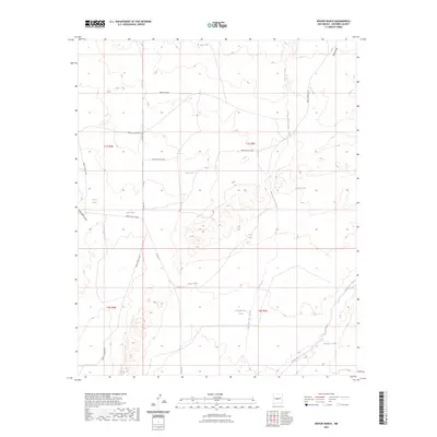
2023 Map of Bishop Ranch
USGS Topo · Published 2023About this map
Rancho Viejo Arroyo and Chupadera Arroyo carve through this high desert terrain in Socorro County, New Mexico. The landscape is defined by an extensive network of water management features, including several named earthen reservoirs like Baumgardner Tank, Arrese Tank, and Roebuck Tank. These small catchments are essential infrastructure in the arid Chihuahuan Desert environment, indicating the land's primary use for livestock grazing.
Find a feature on this map
24 named features on this map. Tap any name to fly to it.
Don’t see what you’re looking for? This feature index may not catch every label — zoom into the map to look around manually.
Map Details
Editions of this 2023 Bishop Ranch Map
This is the sole edition of this map. No revisions or reprints were ever made.
Other maps of this area

1916 · La Joya
USGS Topo · 1:125,000

1952 · Cerro Montoso
USGS Topo · 1:24,000

1954 · Socorro
USGS Topo · 1:250,000

1958 · Socorro
USGS Topo · 1:250,000

1962 · Socorro
USGS Topo · 1:250,000
1972 · Sierra Larga North
USGS Topo · 1:24,000
1972 · Chupadera Spring
USGS Topo · 1:24,000

1972 · Chupadera
USGS Topo · 1:24,000

1972 · Wilson Ranch
USGS Topo · 1:24,000
1972 · Sierra Larga South
USGS Topo · 1:24,000